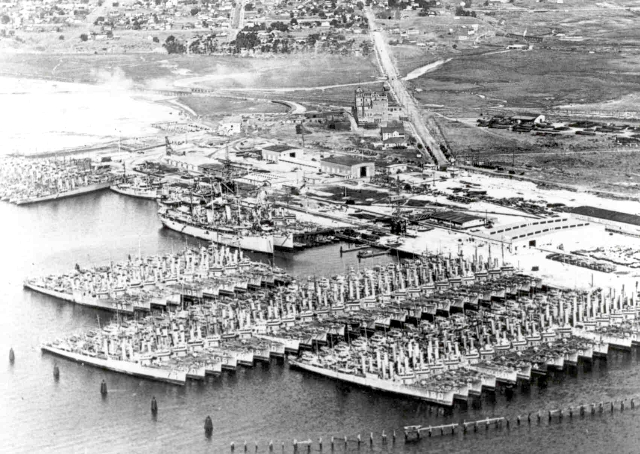
 Linder, Bruce P. (2001). San Diego's Navy: An Illustrated History, Naval Institute Press, 272 pages. Bruce, is a retired Navy captain, grew up in San Diego, attended the Naval Academy, and eventually commanded the San Diego Naval Training Center during one of three tours of duty in San Diego. About his book, he said that he included over 150 photos and tried hard to concentrate on ones that had not been previously published. Here is one of his pictures of "Destroyer Row" at the 32nd Street Navy Base in the south bay of San Diego.
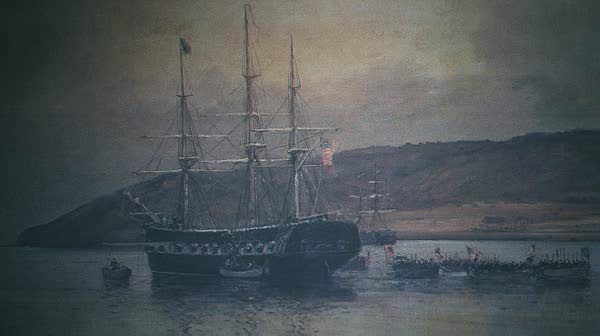 Paez, Jaun. (1968). Cabrillo's Log: 1542-1543. San Diego, CA: Cabrillo Historical Association. Imagine a tiny cabin on an early ship as Captain Cabrillo sets for sea on June 27, 1542. The window before his desk is small and he writes slowly in his log using a large candle and quill. Ninety-three days later, on Thursday, September 28th, they "found a very good enclosed port, to which they give the name of San Miguel (San Diego)...and after anchoring they went ashore, where there were people. Of these, three waited, and all the others ran away. To these three they gave some gifts" (p. 6). The picture I took and shown on the right (not in this book) exemplifies what the early ships must have looked like. Click on the picture for a larger view.